Le Châtelard
Inpostasion de letura
| Le Châtelard (fr) | |||||||||||
|---|---|---|---|---|---|---|---|---|---|---|---|
|
|||||||||||
 | |||||||||||
| Pozision | |||||||||||
| Stato | Fransa | ||||||||||
| Teritòrio | Fransa metropułitana | ||||||||||
| Rejon | Alvergna-Rodano-Alpe | ||||||||||
| Departemento | Savoja | ||||||||||
| Arrondissement | Arrondissement de Chambéry | ||||||||||
| Canton | canton del Châtelard | ||||||||||
| Cavedałe de | |||||||||||
| Popołasion | |||||||||||
| Totałe | 659 (2021) | ||||||||||
| Densità | 36,61 hab./km² | ||||||||||
| Zènaro |
| ||||||||||
| Zeografia | |||||||||||
| Àrea | 18 km²[1] | ||||||||||
| Altitùdene | 608 m[2]-1 920 m[2] | ||||||||||
| Rente a | |||||||||||
| Còdazi de identifegasion | |||||||||||
| Còdaze postałe | 73630 | ||||||||||
| Fuzo oràrio | |||||||||||
| Sito web | lechatelard.fr | ||||||||||
|
| |||||||||||
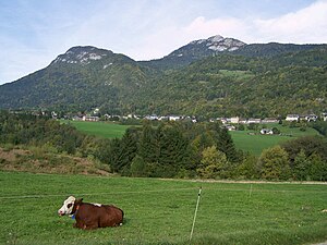
Le Châtelard el xe on comun de 670 abitanti del departemento de Savoja che el fa parte del rejon Alvergna-Rodano-Alpe in Fransa.
Evołusion demogràfega
[canbia | canbia el còdaxe]Abitanti censii

Altri projeti
[canbia | canbia el còdaxe] Wikimedia Commons el detien imàjini o altri file so Le Châtelard
 el detien schemi gràfeghi so
Łigamenti foresti
[canbia | canbia el còdaxe]| Controło de autorità | VIAF (EN) 125239226 · BNF (FR) cb15274015n (data) · WorldCat Identities (EN) 125239226 |
|---|
- ↑ Declarà da: répertoire géographique des communes. Data de consultasion: 26 de otobre del 2015. Editor: Institut géographique national.
- ↑ 2,0 2,1 voze de refarensawxs-telechargement.ign.fr.


