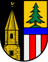
Altmünster
Ła version stabiłe ła xe stà verifegà el 12 luj 2023. Ghe xe
canbiamenti a modèłi e/o file in sta version in atexa de revixion.
| Altmünster (de) | |||||
|---|---|---|---|---|---|
|
|||||
| Pozision | |||||
| Stato | Àustria | ||||
| Stato federà | Alta Austria | ||||
| Distreto | Gmunden | ||||
| Popołasion | |||||
| Totałe | 9 793 (1° de zenaro del 2018) | ||||
| Densità | 124,07 hab./km² | ||||
| Zeografia | |||||
| Àrea | 78,93 km²[1] | ||||
| Altitùdene | 442 m | ||||
| Rente a | |||||
| Organizasion pułìtega | |||||
| Cao de goerno | Elisabeth Feichtinger (it) | ||||
| Còdazi de identifegasion | |||||
| Còdaze postałe | 4813 | ||||
| Còdaze de matricołasion | GM | ||||
| Fuzo oràrio | |||||
| Còdaze munisìpio de Àustria | 40701 | ||||
| Sito web | altmuenster.at | ||||
|
| |||||
Altmünster
el xe on comun marcà del distreto de Gmunden che el fa parte del stato de ła Alta Àustria in Austria
Evołusion demografica[canbia | canbia el còdaxe]
Altri projeti[canbia | canbia el còdaxe]
 Wikimedia Commons el detien imàjini o altri file so Altmünster
Łigadure foreste[canbia | canbia el còdaxe]
- ↑ voze de refarensastatistik.at.
- ↑ 2,0 2,1 2,2 2,3 2,4 2,5 2,6 Declarà da: OpenStreetMap. Łéngua de l'òpara o del nòme: multiłéngua. Data de publicasion: 9 de agosto del 2004.
| Controło de autorità | VIAF (EN) 244631208 · LCCN (EN) no2008050191 · GND (DE) 4240295-5 · BNF (FR) cb156159881 (data) · WorldCat Identities (EN) no2008-050191 |
|---|


