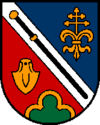
Schardenberg
Ła version stabiłe ła xe stà verifegà el 12 luj 2023. Ghe xe
canbiamenti a modèłi e/o file in sta version in atexa de revixion.
|
|||||
| Pozision | |||||
|---|---|---|---|---|---|
| Stato | Àustria | ||||
| Stato federà | Alta Austria | ||||
| Distreto | Schärding | ||||
| Popołasion | |||||
| Totałe | 2 407 (1° de zenaro del 2018) | ||||
| Densità | 75,22 hab./km² | ||||
| Zeografia | |||||
| Àrea | 32 km² | ||||
| Altitùdene | 543 m | ||||
| Rente a | |||||
| Organizasion pułìtega | |||||
| Menbro de | |||||
| Còdazi de identifegasion | |||||
| Còdaze postałe | 4784 | ||||
| Còdaze de matricołasion | SD | ||||
| Fuzo oràrio | |||||
| Prefiso tełefònego | 07713 | ||||
| Còdaze munisìpio de Àustria | 41423 | ||||
| Sito web | schardenberg.at | ||||
|
| |||||
Schardenberg
el xe on comun marcà del distreto de Schärding che el fa parte del stato de ła Alta Àustria in Austria
Evołusion demografica[canbia | canbia el còdaxe]
Altri projeti[canbia | canbia el còdaxe]
 Wikimedia Commons el detien imàjini o altri file so Schardenberg
Łigadure foreste[canbia | canbia el còdaxe]
- ↑ URL de refarensa: http://www.klimabuendnis.org/nc/kommunen/das-netzwerk.html.
| Controło de autorità | VIAF (EN) 238141804 · GND (DE) 4745330-8 · WorldCat Identities (EN) 238141804 |
|---|


