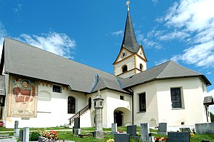
Köttmannsdorf
Inpostasion de letura
| Köttmannsdorf (de) | |||||
|---|---|---|---|---|---|
|
|||||
 | |||||
| Pozision | |||||
| Stato | Àustria | ||||
| Stato federà | Carìnsia | ||||
| Distreto | Klagenfurt-Land | ||||
| Popołasion | |||||
| Totałe | 3 004 (2018) | ||||
| Densità | 106,68 hab./km² | ||||
| Zeografia | |||||
| Àrea | 28,16 km²[1] | ||||
| Altitùdene | 558 m | ||||
| Rente a | |||||
| Còdazi de identifegasion | |||||
| Còdaze postałe | 9071 | ||||
| Còdaze de matricołasion | KL | ||||
| Fuzo oràrio | |||||
| Prefiso tełefònego | 04220 | ||||
| Còdaze munisìpio de Àustria | 20414 | ||||
| Sito web | koettmannsdorf.at | ||||
|
| |||||
Köttmannsdorf el xe on comun del Distreto de Klagenfurt-Land che el fa parte del land de ła Carinsia in Austria
Evołusion demografica
[canbia | canbia el còdaxe]Altri projeti
[canbia | canbia el còdaxe] Wikimedia Commons el detien imàjini o altri file so Köttmannsdorf
 el detien schemi gràfeghi so
Łigadure foreste
[canbia | canbia el còdaxe]- ↑ voze de refarensastatistik.at.
| Controło de autorità | VIAF (EN) 168320953 · GND (DE) 4523427-9 · WorldCat Identities (EN) 168320953 |
|---|


