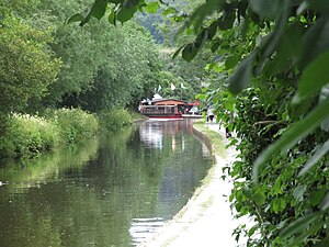
Canal Llangollen
 | ||||
| Sorte | Canałe | |||
|---|---|---|---|---|
| Liogo | ||||
| Rejon aministrativa | Rènjo Unìo | |||
|
| ||||
El Canal Llangollen el xe un canal navigàbiłe sol confin intrà Inghiltera e Gałes. Sto corso de aqua el łiga Llangollen xona Denbighshire, Gałes del Nord, co Hurleston xona Cheshire, traverso ła sità de Ellesmere, Shropshire. Intel 2009 ła xona da Gledrid Bridge visin Rhoswiel fin łe Cascade de Horseshoe, incluxo el Chirk Aqueduct e el Pontcysyllte Aqueduct, xe stà dichiarà World Heritage site dal UNESCO.
Declin[canbia | canbia el còdaxe]
Dal 1936 le navigasion comerciali le xe ndae in disuxo parché xe stà verto n'altro canal pi stratègico. Dal 1939 le barche da Hurleston a Llangollen no le pasa altro. Intel 1944 se ga fermà tuto.
Descrision puntuałi[canbia | canbia el còdaxe]
El ponte levatoio de Wrenbury ga un sistema da bariere pa fermar el tràfico so goma, se necesario.
Fra i ponti 44 e 47 el canal pasa traverso Whixall Moss. A Ellesmere se separa un ramo picenin verso el sentro çità
El Canal Llangollen pasa traverso Hindford, Saint Martin's, Preesgweene, Chirk Bank, Chirk e Froncysyllte, e el include el Chirk Aqueduct, el Chirk Tunnel e anca el Pontcysyllte Aqueduct.
Łigadure foreste[canbia | canbia el còdaxe]
- Llangollen Canal Archivià il 10 de zunjo 2011 in Internet Archive.
– Sito internet del North Wales Borderlands
 Wikimedia Commons el detien imàjini o altri file so Canal Llangollen
| Controło de autorità | VIAF (EN) 315144181 · LCCN (EN) sh85077839 · WorldCat Identities (EN) 315144181 |
|---|

