
File:Vendée department relief location map.jpg

Dimension de sta anteprima: 800 × 525 pixel. Altre risołusion: 320 × 210 pixel | 640 × 420 pixel | 1 024 × 672 pixel | 1 386 × 909 pixel.
File orixenałe (1 386 × 909 pixel, dimension del file: 299 KB, tipo MIME: image/jpeg)
Somario
| Descrision |
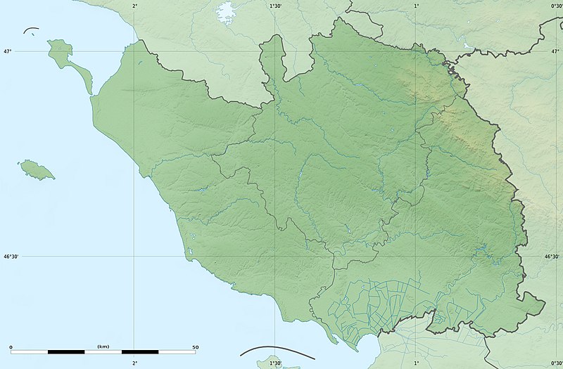
English: Blank physical map of the department of Vendée, France, as in February 2011, for geo-location purpose, with distinct boundaries for regions, departments and arrondissements.
Français : Carte physique vierge du département de la Vendée, France, telle qu'en février 2011, destinée à la géolocalisation, avec limite distincte des régions, départements et arrondissements. Scales:
Equirectangular projection, WGS84 datum
Geographic limits of the map:
|
||
| Data | |||
| Provenjiensa |
Opara propia
|
||
| Autore | Eric Gaba (Sting - fr:Sting) | ||
| Liçensa (Ridoparar sto file) |
|
||
| Altre version |
|

| Posission de la màchina fotogràfega | | La posission de sta qua e de altre imagini su: OpenStreetMap |
|---|
Licensa de doparasion:
Eric Gaba, Wikimedia Commons user Sting, che el detien el dirito d'autor su sta opera, el la pùblica qua soto la seguente licensa:
Sto file el xe soto ła liçensa Creative Commons Atribusion-Spartisi in te ła stesa manjiera 3.0 Xenèrego.
Atribusion: Eric Gaba, Wikimedia Commons user Sting
- Te si libaro:
- de spartire in jiro – de copiar, distribuir e trasmétar sta opera
- de modifegar – de adatar sta opera
- Soto le seguenti condision:
- atribussion – Te ghe da atribuir ƚa paternità de ƚ'opera ne i modi indicà de l'autor o da chi te gà dà l'opera en lisensa, e en modo tale da no sugerir che lori i sia d'acordo con ti o col modo che te dòpari l'opera.
- spartisi in te ła stesa manjiera – Se te mis-ci, trasformi o dexviłupi sto laoro, te ghè da spartire łe to contribusion segondo ła stesa liçensa o na conpatibiłe a l'orixenałe.
Istoria del file
Schicia so on grupo data/or pa vedare el file come che el se presentava in tel momento indegà.
| Data/Ora | Miniadura | Dimension | Utente | Comento | |
|---|---|---|---|---|---|
| In ultima | 23:38, 2 mar 2011 | | 1 386 × 909 (299 KB) | Sting | == {{int:filedesc}} == {{Information |Description={{en|Blank physical map of the department of Vendée, France, as in February 2011, for geo-location purpose, with distinct boundaries for regions, departments and arrondissements.}} {{fr|Ca |
Doparasion del file
Nisuna pajina ła dopara sto file
Doparasion globałe del file
St'altre wiki cua le dopara sto file:
- Uxo de als.wikipedia.org inte le pàjine
- Uxo de de.wikipedia.org inte le pàjine
- Uxo de eo.wikipedia.org inte le pàjine
- Uxo de fr.wikipedia.org inte le pàjine
- Saint-Denis-du-Payré
- La Roche-sur-Yon
- Les Sables-d'Olonne (ancienne commune)
- Grosbreuil
- Saint-Hilaire-la-Forêt
- Montaigu (Vendée)
- Fontenay-le-Comte
- Maillezais
- Noirmoutier-en-l'Île
- Île de Noirmoutier
- Luçon (Vendée)
- Marais poitevin
- Vouvant
- Nesmy
- La Montagne (Loire-Atlantique)
- Mouilleron-en-Pareds
- Pissotte
- Aizenay
- La Ferrière (Vendée)
- Géographie de la Vendée
- Challans
- L'Épine (Vendée)
- Saint-Florent-des-Bois
- Mesnard-la-Barotière
- Saint-Germain-l'Aiguiller
- Saint-Christophe-du-Ligneron
- Givrand
- Le Givre
- Saint-Gilles-Croix-de-Vie
- Beaulieu-sous-la-Roche
- Saint-Hilaire-de-Riez
- Pouzauges
- Saint-Michel-en-l'Herm
- Bourneau
- La Tranche-sur-Mer
- Chantonnay
- Talmont-Saint-Hilaire
- Chavagnes-en-Paillers
- Angles (Vendée)
- Barbâtre (Vendée)
- Expédition de l'île d'Yeu
- Pertuis Breton
Varda ła doparasion globałe de sto file.