
File:Relief Map of Bulgaria.jpg

Dimension de sta anteprima: 800 × 505 pixel. Altre risołusion: 320 × 202 pixel | 640 × 404 pixel | 1 024 × 646 pixel | 1 280 × 808 pixel | 1 642 × 1 036 pixel.
File orixenałe (1 642 × 1 036 pixel, dimension del file: 459 KB, tipo MIME: image/jpeg)
Somario
| Descrision |
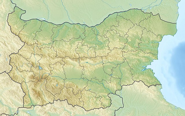
English: Location map of Bulgaria Equirectangular projection, N/S stretching 130 %. Geographic limits of the map:
|
| Data | (UTC) |
| Provenjiensa |
|
| Autore |
|
| Altre version | Derivative works of this file: Relief Map of Bulgaria Burgasebene.jpg |
| Sta qua la xe na imagine ritocà, che vol dir che la xe stà modificà digitalmente rispeto a la so version original. Modifiche: {{{1}}}. L'original el se pol védar qua: Bulgaria location map.svg.
|
Licensa de doparasion:
Mi, che detegno el dirito d'autor su sta opera, la pùblico qua soto le seguenti license:
Sto file el xe soto ła liçensa Creative Commons Atribusion-Spartisi in te ła stesa manjiera 3.0 Xenèrego.
- Te si libaro:
- de spartire in jiro – de copiar, distribuir e trasmétar sta opera
- de modifegar – de adatar sta opera
- Soto le seguenti condision:
- atribussion – Te ghe da atribuir ƚa paternità de ƚ'opera ne i modi indicà de l'autor o da chi te gà dà l'opera en lisensa, e en modo tale da no sugerir che lori i sia d'acordo con ti o col modo che te dòpari l'opera.
- spartisi in te ła stesa manjiera – Se te mis-ci, trasformi o dexviłupi sto laoro, te ghè da spartire łe to contribusion segondo ła stesa liçensa o na conpatibiłe a l'orixenałe.

|
Se autorixa ła copia, distribusion y modifegasion de sto documento soto i termani de ła liçensa de documentasion libara GNU, version 1.2 o calsiasi altra version dopo, publegada da ła Fonsasion par el Software Libaro; sensa sesion invariabiłi, testi de coertina e njianca testi de contro-coertina. Se include na copia de ła pena dita liçensa in te ła sesion intitołada Liçensa de Documentasion Libara GNU. |
Te połi segnare ła liçensa che te prefarisi
Registro original del caricamento
This image is a derivative work of the following images:
- File:Bulgaria_location_map.svg licensed with Cc-by-sa-3.0, GFDL
- 2010-10-06T18:28:14Z NordNordWest 1642x1036 (282074 Bytes) upd
- 2009-08-12T18:23:52Z Пакко 1536x970 (209136 Bytes) fixed Iskar Lake
- 2009-08-03T18:12:56Z Пакко 1534x967 (211583 Bytes) fixed some borders according to current administrative division
- 2008-08-25T18:52:33Z NordNordWest 1645x1038 (304442 Bytes) size correction
- 2008-08-12T12:25:58Z NordNordWest 548x346 (298143 Bytes) corrected
- 2008-08-05T20:30:09Z NordNordWest 548x346 (296113 Bytes) {{Information |Description= {{de|Positionskarte von [[:de:Bulgarien|Bulgarien]]}} Quadratische Plattkarte, N-S-Streckung 130 %. Geographische Begrenzung der Karte: * N: 44.4° N * S: 41.1° N * W: 22.1° O * O: 28.9° O {{en|
Uploaded with derivativeFX
Istoria del file
Schicia so on grupo data/or pa vedare el file come che el se presentava in tel momento indegà.
| Data/Ora | Miniadura | Dimension | Utente | Comento | |
|---|---|---|---|---|---|
| In ultima | 11:20, 3 avr 2016 | | 1 642 × 1 036 (459 KB) | Pticy uleteli | унификация разрешения с административной картой для корректной работы imagemap |
| 12:26, 28 nov 2010 |  | 1 200 × 757 (306 KB) | Виктор В | {{Information |Description={{en|Location map of Bulgaria}} Equirectangular projection, N/S stretching 130 %. Geographic limits of the map: * N: 44.4° N * S: 41.1° N * W: 22.1° E * E: 28.9° E |Source=*[[:File:Bulgaria_location_map. |
Doparasion del file
Ła pajina che vien ła dopara sto file:
Doparasion globałe del file
St'altre wiki cua le dopara sto file:
- Uxo de am.wikipedia.org inte le pàjine
- Uxo de ar.wikipedia.org inte le pàjine
- Uxo de ast.wikipedia.org inte le pàjine
- Uxo de azb.wikipedia.org inte le pàjine
- Uxo de az.wikipedia.org inte le pàjine
- Şablon:Yer xəritəsi Bolqarıstan
- Pirin Milli Parkı
- Rodop dağları
- Srebırna Təbiət Qoruğu
- Maqura mağarası
- Pirin
- Belintaş
- Balkan dağları
- Mərkəzi Balkan Milli Parkı
- Əminə burnu
- Kom dağı
- Stara-Reka qoruğu
- Bayuvi-Dupki — Cincirsa
- Uzunbucaq
- Yulen qoruğu
- Orelyak qoruğu
- Sıyeva dupka
- Buynovsk dərəsi
- Uxlovitsa mağarası
- Triqrad dərəsi
- Kamçiya qoruğu
- Ali Botuş qoruğu
- Pobiti daşları
- Torfeno Branişte
- Bistrişko Branişte
- Poda Qorunan Təbiət Ərazisi
- Beloslav gölü
- Proxodna mağarası
- Rozhen Rəsədxanası
- Uxo de ban.wikipedia.org inte le pàjine
- Uxo de ba.wikipedia.org inte le pàjine
- Uxo de be.wikipedia.org inte le pàjine
Varda ła doparasion globałe de sto file.