
File:Namibia location map.svg

Dimensioni di questa anteprima PNG per questo file SVG: 623 × 600 pixel. Altre risołusion: 249 × 240 pixel | 498 × 480 pixel | 797 × 768 pixel | 1 063 × 1 024 pixel | 2 127 × 2 048 pixel | 1 300 × 1 252 pixel.
File orixenałe (file en formato SVG, dimension nominałi 1 300 × 1 252 pixel, dimension del file: 196 KB)
Somario
| Descrision |
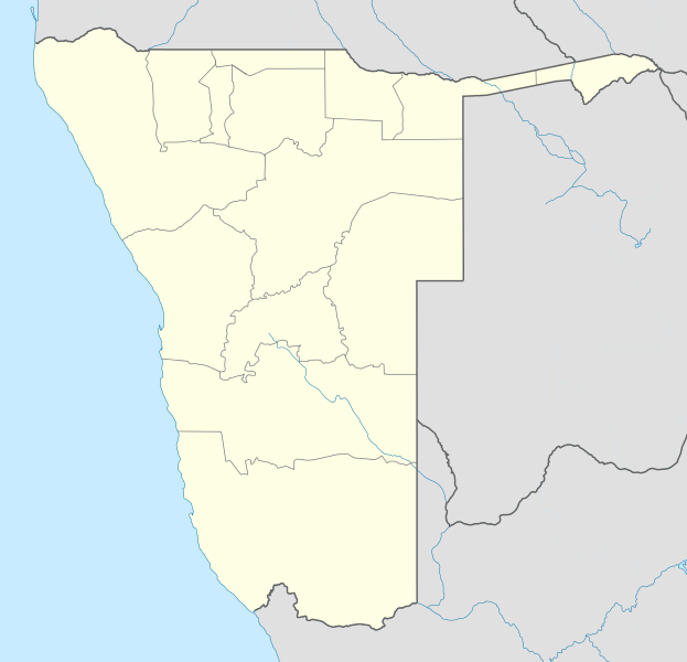
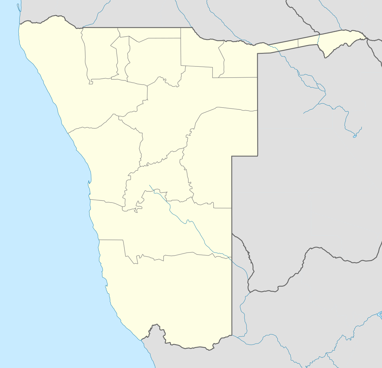
Deutsch: Location map of Namibia
Equirectangular projection. Strechted by 108.0%. Geographic limits of the map:
|
| Data | |
| Provenjiensa | Opara propia |
| Autore | Uwe Dedering |
| Altre version |
|

Licensa de doparasion:
Uwe Dedering di Wikipedia in todesco, che el detien el dirito d'autor su sta opera, el la pùblica qua soto le seguenti license:

|
Se autorixa ła copia, distribusion y modifegasion de sto documento soto i termani de ła liçensa de documentasion libara GNU, version 1.2 o calsiasi altra version dopo, publegada da ła Fonsasion par el Software Libaro; sensa sesion invariabiłi, testi de coertina e njianca testi de contro-coertina. Se include na copia de ła pena dita liçensa in te ła sesion intitołada Liçensa de Documentasion Libara GNU. |
Sto file el xe soto ła liçensa Creative Commons Atribusion-Spartisi in te ła stesa manjiera 3.0 Xenèrego.
Atribusion: Uwe Dedering di Wikipedia in todesco
- Te si libaro:
- de spartire in jiro – de copiar, distribuir e trasmétar sta opera
- de modifegar – de adatar sta opera
- Soto le seguenti condision:
- atribussion – Te ghe da atribuir ƚa paternità de ƚ'opera ne i modi indicà de l'autor o da chi te gà dà l'opera en lisensa, e en modo tale da no sugerir che lori i sia d'acordo con ti o col modo che te dòpari l'opera.
- spartisi in te ła stesa manjiera – Se te mis-ci, trasformi o dexviłupi sto laoro, te ghè da spartire łe to contribusion segondo ła stesa liçensa o na conpatibiłe a l'orixenałe.
Sto file el xe soto la licensa Creative Commons Atribusion-Condividi a lo stesso modo 3.0 Germania.
Atribusion: Uwe Dedering di Wikipedia in todesco
- Te si libaro:
- de spartire in jiro – de copiar, distribuir e trasmétar sta opera
- de modifegar – de adatar sta opera
- Soto le seguenti condision:
- atribussion – Te ghe da atribuir ƚa paternità de ƚ'opera ne i modi indicà de l'autor o da chi te gà dà l'opera en lisensa, e en modo tale da no sugerir che lori i sia d'acordo con ti o col modo che te dòpari l'opera.
- spartisi in te ła stesa manjiera – Se te mis-ci, trasformi o dexviłupi sto laoro, te ghè da spartire łe to contribusion segondo ła stesa liçensa o na conpatibiłe a l'orixenałe.

Te połi segnare ła liçensa che te prefarisi
Registro original del caricamento
Transferred from de.wikipedia to Commons by Uwe Dedering.
The original description page was here. All following user names refer to de.wikipedia.
- 2010-02-16 11:11 Uwe Dedering 1300×1252× (303033 bytes) {{Information |Beschreibung = Location map of Namibia Equirectangular projection. Strechted by 108.0%. Geographic limits of the map: * N: -16.0° N * S: -29.0° N * W: 11.0° E * E: 25.0° E Made with Natural Earth. Free vector and raster map data
Istoria del file
Schicia so on grupo data/or pa vedare el file come che el se presentava in tel momento indegà.
| Data/Ora | Miniadura | Dimension | Utente | Comento | |
|---|---|---|---|---|---|
| In ultima | 20:57, 12 oto 2013 | | 1 300 × 1 252 (196 KB) | NordNordWest | upd |
| 23:50, 16 feb 2010 |  | 1 300 × 1 252 (296 KB) | Uwe Dedering | {{Information |Description={{de|Location map of Namibia Equirectangular projection. Strechted by 108.0%. Geographic limits of the map: * N: -16.4° N * S: -29.6° N * W: 11.0° E * E: 25.8° E Made with Natural Earth. Free vector and raster map data @ nat |
Doparasion del file
Ła pajina che vien ła dopara sto file:
Doparasion globałe del file
St'altre wiki cua le dopara sto file:
- Uxo de af.wikipedia.org inte le pàjine
- Walvisbaai
- Oranjemund
- Karasburg
- Omaruru
- Karibib
- Usakos
- Otjiwarongo
- Keetmanshoop
- Olifantsrivier
- Mariental
- Maltahöhe
- Hentiesbaai
- Langstrand
- Grootfontein
- Vaalgras
- Rehoboth
- Rundu
- Gobabis
- Warmbad, Namibië
- Tsumeb
- Bethanie
- Otjimbingwe
- Seeheim
- Sjabloon:Liggingkaart Namibië
- Fransfontein
- Omuthiya
- Luhonono
- Namibwoestyn
- Noordoewer
- Arandis
- Aranos
- Kalkfeld
- Outjo
- Otavi
- Witvlei
- Oshakati
- Brukkaros
- Aus
- Asab
- Okahandja
- Suid-Afrikaanse Lugdiens-vlug 228
- Ramansdrift
- Hosea Kutako Internasionale Lughawe
- Windhoek Eros-lughawe
- Walvisbaai-lughawe
- Grootfonteinlughawe
- Katima Mulilo-lughawe
- Ondangwa
- Katima Mulilo
- Gochas
Varda ła doparasion globałe de sto file.