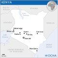
File:Kenya - Location Map (2013) - KEN - UNOCHA.svg
Inpostasion de letura

Dimensioni di questa anteprima PNG per questo file SVG: 253 × 252 pixel. Altre risołusion: 241 × 240 pixel | 482 × 480 pixel | 771 × 768 pixel | 1 028 × 1 024 pixel | 2 056 × 2 048 pixel.
File orixenałe (file en formato SVG, dimension nominałi 253 × 252 pixel, dimension del file: 414 KB)
Istoria del file
Schicia so on grupo data/or pa vedare el file come che el se presentava in tel momento indegà.
| Data/Ora | Miniadura | Dimension | Utente | Comento | |
|---|---|---|---|---|---|
| In ultima | 04:23, 18 nov 2014 |  | 253 × 252 (414 KB) | Pharos | try without logo for now |
| 22:27, 15 luj 2014 |  | 253 × 252 (346 KB) | Palmerop | User created page with UploadWizard |
Doparasion del file
Ła pajina che vien ła dopara sto file:
Doparasion globałe del file
St'altre wiki cua le dopara sto file:
- Uxo de arz.wikipedia.org inte le pàjine
- Uxo de ast.wikipedia.org inte le pàjine
- Uxo de as.wikipedia.org inte le pàjine
- Uxo de ckb.wikipedia.org inte le pàjine
- Uxo de csb.wikipedia.org inte le pàjine
- Uxo de dag.wikipedia.org inte le pàjine
- Uxo de de.wikivoyage.org inte le pàjine
- Uxo de diq.wikipedia.org inte le pàjine
- Uxo de eo.wikinews.org inte le pàjine
- Uxo de eu.wikipedia.org inte le pàjine
- Uxo de fr.wikipedia.org inte le pàjine
- Uxo de fr.wikinews.org inte le pàjine
- Uxo de ga.wikipedia.org inte le pàjine
- Uxo de gl.wikipedia.org inte le pàjine
- Uxo de gpe.wikipedia.org inte le pàjine
- Uxo de ha.wikipedia.org inte le pàjine
- Uxo de he.wikivoyage.org inte le pàjine
- Uxo de hi.wikipedia.org inte le pàjine
- Uxo de hi.wiktionary.org inte le pàjine
- Uxo de ht.wikipedia.org inte le pàjine
- Uxo de ia.wikipedia.org inte le pàjine
- Uxo de id.wikipedia.org inte le pàjine
- Uxo de incubator.wikimedia.org inte le pàjine
- Uxo de it.wikipedia.org inte le pàjine
- Uxo de kab.wikipedia.org inte le pàjine
- Uxo de mdf.wikipedia.org inte le pàjine
- Uxo de mg.wikipedia.org inte le pàjine
- Uxo de mos.wikipedia.org inte le pàjine
- Uxo de pcm.wikipedia.org inte le pàjine
- Uxo de pl.wikipedia.org inte le pàjine
- Uxo de rw.wikipedia.org inte le pàjine
- Uxo de sco.wikipedia.org inte le pàjine
- Uxo de ta.wikipedia.org inte le pàjine
- Uxo de tt.wikipedia.org inte le pàjine
- Uxo de www.wikidata.org inte le pàjine

