
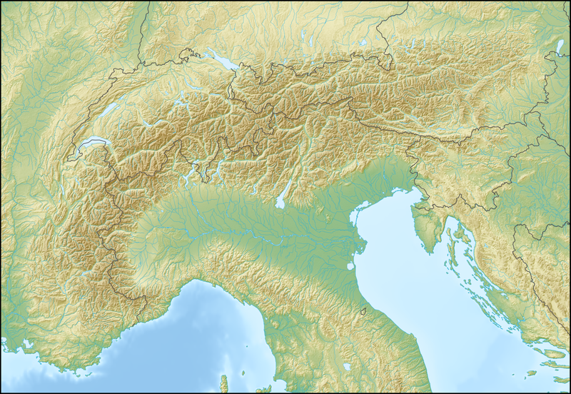
File:Alps location map.png

Dimension de sta anteprima: 800 × 552 pixel. Altre risołusion: 320 × 221 pixel | 640 × 442 pixel | 1 024 × 707 pixel | 1 280 × 884 pixel | 2 000 × 1 381 pixel.
File orixenałe (2 000 × 1 381 pixel, dimension del file: 4,73 MB, tipo MIME: image/png)
.png)
.png)
.png)
.png)
.png)
.png)
.png)
.png)
.png)
.png)
.png)
.png)
.png)
.png)
.png)
.png)
.png)
.png)
.png)
.png)
.png)
.png)
.png)
.png)
.png)
.png)
.png)
.png)
.png)
.png)
.png)
.png)
.png)
.png)
.png)
.png)
.png)
.png)
.png)
.png)
.png)

|
Questa mappa è stata prodotta e/o migliorata nel Kartenwerkstatt, il laboratorio grafico della Wikipedia tedesca, dove è possible proporre mappe da migliorare.
|
Licensa de doparasion:
La mappa è stata creata con Generic Mapping Tools: https://generic-mapping-tools.org/ usando una o più di queste banchedati in pubblico dominio per i rilievi:
|

|
Se autorixa ła copia, distribusion y modifegasion de sto documento soto i termani de ła liçensa de documentasion libara GNU, version 1.2 o calsiasi altra version dopo, publegada da ła Fonsasion par el Software Libaro; sensa sesion invariabiłi, testi de coertina e njianca testi de contro-coertina. Se include na copia de ła pena dita liçensa in te ła sesion intitołada Liçensa de Documentasion Libara GNU. |
| Sto file el xe soto ła liçensa Creative Commons Atribusion-Spartisi in te ła stesa manjiera 3.0 Xenèrego. | ||
| ||
| Sto tag de copyright lo gavemo zontà ne l'ànbito de l'ajornamento de la licensa dei progeti Wikimedia. |
Istoria del file
Schicia so on grupo data/or pa vedare el file come che el se presentava in tel momento indegà.
| Data/Ora | Miniadura | Dimension | Utente | Comento | |
|---|---|---|---|---|---|
| In ultima | 14:58, 20 feb 2009 | | 2 000 × 1 381 (4,73 MB) | Lencer | {{Information |Description= {{de|Positionskarte der Alpen}} Quadratische Plattkarte. Geographische Begrenzung der Karte: * N: 48.5 ° N * S: 42.75 ° N * W: 4.5 ° O * O: 17 ° O {{en|Location map of the Alps}} Equirecta |
Doparasion del file
Łe che vien 2 pajine, łe dopara sto file:
Doparasion globałe del file
St'altre wiki cua le dopara sto file:
- Uxo de als.wikipedia.org inte le pàjine
- Uxo de an.wikipedia.org inte le pàjine
- Uxo de ar.wikipedia.org inte le pàjine
- Uxo de as.wikipedia.org inte le pàjine
- Uxo de az.wikipedia.org inte le pàjine
- Uxo de ba.wikipedia.org inte le pàjine
- Uxo de be.wikipedia.org inte le pàjine
- Манблан
- Матэргорн
- Шаблон:На карце/Альпы
- Цугшпіцэ
- Грайскія Альпы
- Штахлеркопф
- Заходнія Альпы
- Лігурыйскія Альпы
- Бернскія Альпы
- Праванскія Альпы
- Алечгорн
- Мёнх
- Коцкія Альпы
- Альпы Дафінэ
- Лепанцінскія Альпы
- Высокі Таўэрн
- Гларнскія Альпы
- Юлійскія Альпы
- Юра (горы)
- Граўшпіц
- Рэтыйскія Альпы
- Паўднёвыя Вапняковыя Альпы
- Цэнтральныя Усходнія Альпы
- Лага-Маджорэ
- Адамела
- Берніна (горны масіў)
- Пунта-Перукеці
- Руая (рака)
- Uxo de bg.wikipedia.org inte le pàjine
Varda ła doparasion globałe de sto file.