
File:Rouen France-Conseil-Régional-de-Haute-Normandie-01.jpg

File orixenałe (3 890 × 2 621 pixel, dimension del file: 6,56 MB, tipo MIME: image/jpeg)
Somario
| Descrision |
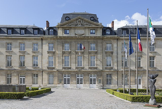
English: Rouen, France: Conseil Régional de Haute-Normandie |
||||||
| Data | |||||||
| Provenjiensa | Opara propia | ||||||
| Autore | CEphoto, Uwe Aranas | ||||||
| Liçensa (Ridoparar sto file) |
|
||||||
| Atribusion (richiesto dalla licenza) | Photo by CEphoto, Uwe Aranas / | ||||||


| Posission del sogeto | | La posission de sta qua e de altre imagini su: OpenStreetMap |
|---|
|
|
Do not upload new revisions over this file version without my explicit consent. Instead, use the possibility to upload a new version under a new name and tag it as a derivate or extract of this file. |

Sta imagine la xe stà valutà doparando le linee guida su la qualità de le imagini e la xe considerà na imagine de qualità.
|
Licensa de doparasion:
- Te si libaro:
- de spartire in jiro – de copiar, distribuir e trasmétar sta opera
- de modifegar – de adatar sta opera
- Soto le seguenti condision:
- atribussion – Te ghe da atribuir ƚa paternità de ƚ'opera ne i modi indicà de l'autor o da chi te gà dà l'opera en lisensa, e en modo tale da no sugerir che lori i sia d'acordo con ti o col modo che te dòpari l'opera.
- spartisi in te ła stesa manjiera – Se te mis-ci, trasformi o dexviłupi sto laoro, te ghè da spartire łe to contribusion segondo ła stesa liçensa o na conpatibiłe a l'orixenałe.
Istoria del file
Schicia so on grupo data/or pa vedare el file come che el se presentava in tel momento indegà.
| Data/Ora | Miniadura | Dimension | Utente | Comento | |
|---|---|---|---|---|---|
| In ultima | 23:32, 9 set 2014 | | 3 890 × 2 621 (6,56 MB) | Cccefalon | {{Information |Description={{en|1=Rouen, France: Conseil Régional de Haute-Normandie}} |Source={{own}} |Date=2014-04-19 |author=CEphoto, Uwe Aranas |permission= |other_versions= |other_fields={{User:Cccefalon/attribution}} {{Object... |
Doparasion del file
Ła pajina che vien ła dopara sto file:
Doparasion globałe del file
St'altre wiki cua le dopara sto file:
- Uxo de ar.wikipedia.org inte le pàjine
- Uxo de az.wikipedia.org inte le pàjine
- Uxo de bn.wikipedia.org inte le pàjine
- Uxo de ca.wikipedia.org inte le pàjine
- Uxo de ce.wikipedia.org inte le pàjine
- Uxo de cs.wikipedia.org inte le pàjine
- Uxo de cy.wikipedia.org inte le pàjine
- Uxo de diq.wikipedia.org inte le pàjine
- Uxo de eo.wikipedia.org inte le pàjine
- Uxo de es.wikipedia.org inte le pàjine
- Uxo de fi.wikipedia.org inte le pàjine
- Uxo de fr.wikipedia.org inte le pàjine
- Uxo de fr.wikinews.org inte le pàjine
- Uxo de fr.wikivoyage.org inte le pàjine
- Uxo de gl.wikipedia.org inte le pàjine
- Uxo de he.wikipedia.org inte le pàjine
- Uxo de kab.wikipedia.org inte le pàjine
- Uxo de ku.wikipedia.org inte le pàjine
- Uxo de no.wikipedia.org inte le pàjine
- Uxo de oc.wikipedia.org inte le pàjine
- Uxo de os.wikipedia.org inte le pàjine
- Uxo de pl.wikipedia.org inte le pàjine
- Uxo de sl.wikipedia.org inte le pàjine
- Uxo de sr.wikipedia.org inte le pàjine
- Uxo de uk.wikipedia.org inte le pàjine
- Uxo de vi.wikipedia.org inte le pàjine
- Uxo de www.wikidata.org inte le pàjine