
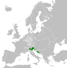
File:Republic of Venice 1789.svg

Dimensioni di questa anteprima PNG per questo file SVG: 450 × 456 pixel. Altre risołusion: 237 × 240 pixel | 474 × 480 pixel | 758 × 768 pixel | 1 011 × 1 024 pixel | 2 021 × 2 048 pixel.
File orixenałe (file en formato SVG, dimension nominałi 450 × 456 pixel, dimension del file: 927 KB)
Somario


.svg)
.svg)
.svg)
.svg)
.svg)


.svg)
.svg)
.svg)


.png)
.png)


.svg)


.svg)

.svg)


.svg)
.svg)
.svg)
.svg)


.svg)
.png)


.svg)


.svg)
.svg)


.svg)


.svg)


.svg)
.svg)
.svg)
.svg)
.svg)
.svg)
.svg)
_cropped.svg)
.svg)
.svg)
.svg)
.svg)
.svg)
.svg)
.svg)
.svg)
.svg)
.svg)
.svg)
.svg)
.svg)
.svg)
.svg)
.svg)
.svg)
.svg)
.svg)
.svg)
.svg)
.svg)
.svg)
.svg)
.svg)
.svg)
.svg)
.svg)
.svg)
.svg)
.svg)
.svg)
.svg)
.svg)
.svg)
.svg)
.svg)
.svg)
.svg)
.svg)
.svg)
.svg)
.svg)
.svg)
.svg)
Licensa de doparasion:
Mi, che detegno el dirito d'autor su sta opera, la pùblico qua soto la seguente licensa:
Sto file el xe soto ła liçensa Creative Commons Atribusion-Spartisi in te ła stesa manjiera 3.0 Xenèrego.
- Te si libaro:
- de spartire in jiro – de copiar, distribuir e trasmétar sta opera
- de modifegar – de adatar sta opera
- Soto le seguenti condision:
- atribussion – Te ghe da atribuir ƚa paternità de ƚ'opera ne i modi indicà de l'autor o da chi te gà dà l'opera en lisensa, e en modo tale da no sugerir che lori i sia d'acordo con ti o col modo che te dòpari l'opera.
- spartisi in te ła stesa manjiera – Se te mis-ci, trasformi o dexviłupi sto laoro, te ghè da spartire łe to contribusion segondo ła stesa liçensa o na conpatibiłe a l'orixenałe.
Registro original del caricamento
This image is a derivative work of the following images:
- File:Europe_1789.svg licensed with Cc-by-sa-3.0
- 2013-04-14T03:44:26Z Alphathon 450x456 (858577 Bytes) Corrected some errors in northern Italy
- 2013-04-14T01:38:01Z Alphathon 450x456 (853881 Bytes) tweaked again
- 2013-04-14T01:36:10Z Alphathon 450x456 (853881 Bytes) Tweaked Holy Roman Empire border style
- 2013-04-14T01:33:26Z Alphathon 450x456 (853857 Bytes) == {{int:filedesc}} == {{Information |Description={{en|A blank Map of Europe circa 1789. This map also includes a border for the [[:en:Holy Roman Empire|Holy Roman Empire]]. Since there are so many small German states, they h
Uploaded with derivativeFX
Istoria del file
Schicia so on grupo data/or pa vedare el file come che el se presentava in tel momento indegà.
| Data/Ora | Miniadura | Dimension | Utente | Comento | |
|---|---|---|---|---|---|
| In ultima | 00:20, 27 nov 2021 | | 450 × 456 (927 KB) | Cplakidas | Fixing Venetian Albania, adding Cythera to Venice |
| 09:55, 17 oto 2021 |  | 450 × 456 (803 KB) | Fenn-O-maniC | Fixed the Russo-Swedish border to match the Treaty of Åbo of 1743 | |
| 11:23, 27 feb 2020 |  | 450 × 456 (821 KB) | Facquis | Clear map | |
| 19:16, 18 avr 2013 |  | 450 × 456 (820 KB) | Alphathon | Various fixes | |
| 05:54, 14 avr 2013 |  | 450 × 456 (802 KB) | Alphathon | == {{int:filedesc}} == {{Information |Description={{en|A map of the Republic of Venice circa 1789.}}{{de|Eine Landkarte die Republik Venedig c. 1989.}} |Source={{Derived from|Europe_1789.svg|display=5... |
Doparasion del file
Nisuna pajina ła dopara sto file
Doparasion globałe del file
St'altre wiki cua le dopara sto file:
- Uxo de azb.wikipedia.org inte le pàjine
- Uxo de bg.wikipedia.org inte le pàjine
- Uxo de ca.wikipedia.org inte le pàjine
- Uxo de ckb.wikipedia.org inte le pàjine
- Uxo de cs.wikipedia.org inte le pàjine
- Uxo de de.wikipedia.org inte le pàjine
- Uxo de el.wikipedia.org inte le pàjine
- Uxo de en.wikipedia.org inte le pàjine
- Uxo de eu.wikipedia.org inte le pàjine
- Uxo de fa.wikipedia.org inte le pàjine
- Uxo de fy.wikipedia.org inte le pàjine
- Uxo de he.wikipedia.org inte le pàjine
- Uxo de hi.wikipedia.org inte le pàjine
- Uxo de hr.wikipedia.org inte le pàjine
- Uxo de it.wikipedia.org inte le pàjine
- Uxo de ko.wikipedia.org inte le pàjine
- Uxo de lfn.wikipedia.org inte le pàjine
- Uxo de lij.wikipedia.org inte le pàjine
- Uxo de lmo.wikipedia.org inte le pàjine
- Uxo de mk.wikipedia.org inte le pàjine
- Uxo de ml.wikipedia.org inte le pàjine
- Uxo de ms.wikipedia.org inte le pàjine
- Uxo de pl.wikipedia.org inte le pàjine
- Uxo de pt.wikipedia.org inte le pàjine
- Uxo de rue.wikipedia.org inte le pàjine
- Uxo de ru.wikipedia.org inte le pàjine
- Uxo de sk.wikipedia.org inte le pàjine
- Uxo de szl.wikipedia.org inte le pàjine
- Uxo de tr.wikipedia.org inte le pàjine
- Uxo de uk.wikipedia.org inte le pàjine
- Uxo de zh.wikipedia.org inte le pàjine