
File:Myanmar location map.svg

Dimensioni di questa anteprima PNG per questo file SVG: 285 × 599 pixel. Altre risołusion: 114 × 240 pixel | 228 × 480 pixel | 365 × 768 pixel | 487 × 1 024 pixel | 975 × 2 048 pixel | 1 200 × 2 520 pixel.
File orixenałe (file en formato SVG, dimension nominałi 1 200 × 2 520 pixel, dimension del file: 633 KB)
Somario
| Descrision |
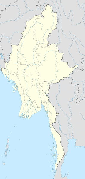
English: Location map of Myanmar. Equirectangular projection. Strechted by 105.0%. Geographic limits of the map: * N: 29.0° N * S: 9.0° N * W: 92.0° E * E: 102.0° E Made with Natural Earth. Free vector and raster map data @ naturalearthdata.com. |
| Data | |
| Provenjiensa | Opara propia |
| Autore | Uwe Dedering |
Licensa de doparasion:
Mi, che detegno el dirito d'autor su sta opera, la pùblico qua soto le seguenti license:
Sto file el xe soto ła liçensa Creative Commons Atribusion-Spartisi in te ła stesa manjiera 3.0 Xenèrego.
- Te si libaro:
- de spartire in jiro – de copiar, distribuir e trasmétar sta opera
- de modifegar – de adatar sta opera
- Soto le seguenti condision:
- atribussion – Te ghe da atribuir ƚa paternità de ƚ'opera ne i modi indicà de l'autor o da chi te gà dà l'opera en lisensa, e en modo tale da no sugerir che lori i sia d'acordo con ti o col modo che te dòpari l'opera.
- spartisi in te ła stesa manjiera – Se te mis-ci, trasformi o dexviłupi sto laoro, te ghè da spartire łe to contribusion segondo ła stesa liçensa o na conpatibiłe a l'orixenałe.

|
Se autorixa ła copia, distribusion y modifegasion de sto documento soto i termani de ła liçensa de documentasion libara GNU, version 1.2 o calsiasi altra version dopo, publegada da ła Fonsasion par el Software Libaro; sensa sesion invariabiłi, testi de coertina e njianca testi de contro-coertina. Se include na copia de ła pena dita liçensa in te ła sesion intitołada Liçensa de Documentasion Libara GNU. |
Te połi segnare ła liçensa che te prefarisi
| Annotations | This image is annotated: View the annotations at Commons |
Istoria del file
Schicia so on grupo data/or pa vedare el file come che el se presentava in tel momento indegà.
| Data/Ora | Miniadura | Dimension | Utente | Comento | |
|---|---|---|---|---|---|
| In ultima | 18:08, 29 set 2011 | | 1 200 × 2 520 (633 KB) | NordNordWest | corr, see disk |
| 19:45, 18 feb 2010 |  | 1 200 × 2 520 (968 KB) | Uwe Dedering | no disputed countries | |
| 15:03, 18 feb 2010 |  | 1 200 × 2 520 (974 KB) | Uwe Dedering | {{Information |Description={{en|1=Location map of Myanmar. Equirectangular projection. Strechted by 105.0%. Geographic limits of the map: * N: 29.0° N * S: 9.0° N * W: 92.0° E * E: 102.0° E Made with Natural Earth. Free vector and raster map dat |
Doparasion del file
Ła pajina che vien ła dopara sto file:
Doparasion globałe del file
St'altre wiki cua le dopara sto file:
- Uxo de af.wikipedia.org inte le pàjine
- Uxo de an.wikipedia.org inte le pàjine
- Uxo de ar.wikipedia.org inte le pàjine
- Uxo de az.wikipedia.org inte le pàjine
- Uxo de ba.wikipedia.org inte le pàjine
- Uxo de be.wikipedia.org inte le pàjine
- Uxo de bg.wikipedia.org inte le pàjine
- Uxo de bh.wikipedia.org inte le pàjine
- Uxo de bn.wikipedia.org inte le pàjine
Varda ła doparasion globałe de sto file.