
File:Map - NL - Municipality code 0518 (2009).svg

Dimensioni di questa anteprima PNG per questo file SVG: 300 × 160 pixel. Altre risołusion: 320 × 171 pixel | 640 × 341 pixel | 1 024 × 546 pixel | 1 280 × 683 pixel | 2 560 × 1 365 pixel.
File orixenałe (file en formato SVG, dimension nominałi 300 × 160 pixel, dimension del file: 530 KB)
| Descrision |
|
|||
| Data | ||||
| Provenjiensa | own work , using CBS data | |||
| Autore | Michiel1972 (talk) 22:53, 24 January 2009 (UTC) | |||
| Liçensa (Ridoparar sto file) |
Attribution ShareAlike 3.0 |

.svg)
Sto file el xe soto ła liçensa Creative Commons Atribusion-Spartisi in te ła stesa manjiera 3.0 Xenèrego.
- Te si libaro:
- de spartire in jiro – de copiar, distribuir e trasmétar sta opera
- de modifegar – de adatar sta opera
- Soto le seguenti condision:
- atribussion – Te ghe da atribuir ƚa paternità de ƚ'opera ne i modi indicà de l'autor o da chi te gà dà l'opera en lisensa, e en modo tale da no sugerir che lori i sia d'acordo con ti o col modo che te dòpari l'opera.
- spartisi in te ła stesa manjiera – Se te mis-ci, trasformi o dexviłupi sto laoro, te ghè da spartire łe to contribusion segondo ła stesa liçensa o na conpatibiłe a l'orixenałe.
Istoria del file
Schicia so on grupo data/or pa vedare el file come che el se presentava in tel momento indegà.
| Data/Ora | Miniadura | Dimension | Utente | Comento | |
|---|---|---|---|---|---|
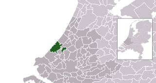
| In ultima | 00:53, 25 zen 2009 | | 300 × 160 (530 KB) | Michiel1972 | {{Information |Description=*Location maps for the 441 municipalities in the Netherlands. Boundaries 1/1/2009 *Automatically generated with script *File name contains "Municipality code" (CBS-code) as specified in: [http://www.cbs.nl/nl-NL/menu/methoden/c |
Doparasion del file
Nisuna pajina ła dopara sto file
Doparasion globałe del file
St'altre wiki cua le dopara sto file:
- Uxo de af.wikipedia.org inte le pàjine
- Uxo de arc.wikipedia.org inte le pàjine
- Uxo de ar.wikipedia.org inte le pàjine
- Uxo de arz.wikipedia.org inte le pàjine
- Uxo de ast.wikipedia.org inte le pàjine
- Uxo de bn.wikipedia.org inte le pàjine
- Uxo de ca.wikipedia.org inte le pàjine
- Uxo de el.wikipedia.org inte le pàjine
- Uxo de en.wikipedia.org inte le pàjine
- Uxo de eu.wikipedia.org inte le pàjine
- Uxo de ext.wikipedia.org inte le pàjine
- Uxo de fa.wikipedia.org inte le pàjine
- Uxo de fr.wikipedia.org inte le pàjine
- Uxo de fr.wikinews.org inte le pàjine
- Uxo de ga.wikipedia.org inte le pàjine
- Uxo de gl.wikipedia.org inte le pàjine
- Uxo de ht.wikipedia.org inte le pàjine
- Uxo de hu.wikipedia.org inte le pàjine
- Uxo de it.wikipedia.org inte le pàjine
- Uxo de la.wikipedia.org inte le pàjine
- Uxo de lb.wikipedia.org inte le pàjine
- Uxo de lij.wikipedia.org inte le pàjine
- Uxo de mk.wikipedia.org inte le pàjine
- Uxo de ml.wikipedia.org inte le pàjine
- Uxo de ms.wikipedia.org inte le pàjine
- Uxo de mzn.wikipedia.org inte le pàjine
- Uxo de nl.wikipedia.org inte le pàjine
- Uxo de oc.wikipedia.org inte le pàjine
- Uxo de ru.wikipedia.org inte le pàjine
- Uxo de stq.wikipedia.org inte le pàjine
- Uxo de tl.wikipedia.org inte le pàjine
- Uxo de tr.wikipedia.org inte le pàjine
- Uxo de uk.wikipedia.org inte le pàjine
- Uxo de ur.wikipedia.org inte le pàjine
- Uxo de vi.wikipedia.org inte le pàjine
- Uxo de vo.wikipedia.org inte le pàjine
- Uxo de www.wikidata.org inte le pàjine
- Uxo de zh.wikipedia.org inte le pàjine
.svg)